ROANOKE RIVER BASIN
CHERRYSTONE CREEK NUTRIENT BANK
The Cherrystone Creek Nutrient Bank can be found on a 38.5 acre property located outside the town of Chatham in Pittsylvania County, Virginia. This property is in the Piedmont Region of Virginia and drains to Cherrystone Creek and the Banister River, before reaching the Roanoke River. This land conversion project improves local and regional water quality by reducing phosphorus, nitrogen, and sediment inputs to local water bodies. This Nutrient Bank services the Roanoke River Basin and generates 37 pounds of phosphorous reduction credits and 179 pounds of nitrogen reduction credits.
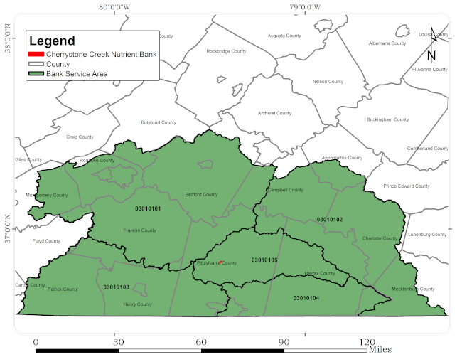
The Cherrystone Creek Nutrient Bank provides nutrient credits for stormwater or TMDL compliance to the following watersheds: Upper Roanoke (HUC 03010101), Middle Roanoke (HUC 03010102), Upper Dan (HUC 03010103), Lower Dan (HUC 03010104), and Banister (HUC 03010105).
The above watersheds service all or part of the following areas:
Altavista
Blairs
Chatham
City of Bedford
City of Danville
City of Martinsville
City of Roanoke
City of Salem
Gladys
Gretna
Moneta
Rocky Mount
South Boston
Appomattox County
Bedford County
Botetourt County
Campbell County
Charlotte County
Franklin County
Halifax County
Henry County
Mecklenburg County
Montgomery County
Patrick County
Pittsylvania County
Roanoke County